Kuwohi
Formerly Clingmans Dome · 6,643 feet
The highest point in the Smokies, with a steep half-mile walk to an observation tower and views across the mountains on a clear day. It was called Clingmans Dome until 2024, and many people still know it by that name.
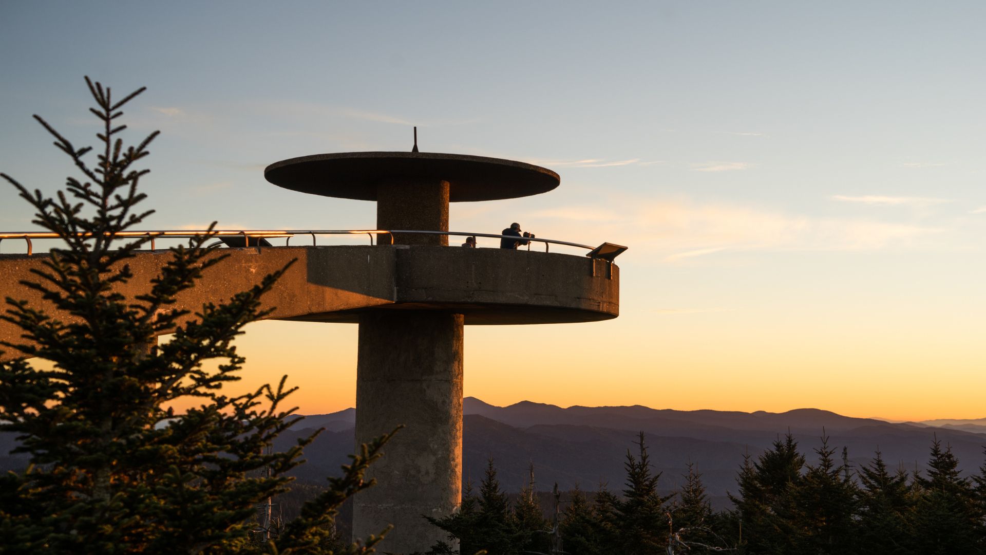
Kuwohi, known for decades as Clingmans Dome, is the highest point in Great Smoky Mountains National Park and in Tennessee, at 6,643 feet. A paved road winds up near the summit, and a steep half-mile walk leads to an observation tower with views in every direction. On a clear day you can see for miles across the Smokies. On a cloudy one, you may be standing inside the clouds.
Elevation: 6,643 feet, the highest point in the park and in Tennessee
Kuwohi Road: about 7 miles from Newfound Gap; open roughly April through November
Trail to the tower: half a mile, paved but steep
Parking tag required; often 10 to 20 degrees cooler than Gatlinburg
Kuwohi or Clingmans Dome?
They're the same mountain. In 2024, the U.S. Board on Geographic Names restored the peak's Cherokee name, Kuwohi, which means "mulberry place." Road signs, park maps, and the National Park Service now use Kuwohi, but you'll still hear Clingmans Dome from locals and longtime visitors, and both names point you to the same place.
Getting there
From Gatlinburg, drive into the park on Newfound Gap Road (US-441) to Newfound Gap, about 30 to 40 minutes from town. Just past the gap, turn onto Kuwohi Road, formerly Clingmans Dome Road, and follow it about 7 miles to the large parking area near the summit. Allow about an hour from Gatlinburg.
When the road is open
Kuwohi Road is usually open from early April through November and closes for the winter. It can also close temporarily for ice, snow, or storms at other times of year. Check the National Park Service road conditions before you go.
Parking tag
Like the rest of the park, you need a parking tag to park at Kuwohi for more than 15 minutes. Buy one online at recreation.gov or at the Sugarlands Visitor Center on your way in.
The walk to the observation tower
From the parking area, a paved trail climbs half a mile to the summit. It's short, but it's steep and the air is thin at this elevation, so take your time and rest along the way. At the top, a spiral ramp leads up the Kuwohi observation tower, a concrete tower with a round viewing platform above the trees.
Most people take about 30 to 45 minutes round trip, plus time at the top. The trail is paved but too steep for most wheelchairs.
The view
On a clear day, the tower offers a 360-degree view across the Smokies and into Tennessee and North Carolina, with ridge after ridge fading into the distance. Haze and clouds are common, though, and the summit is often fogged in. Check the weather and the live webcams, including the park's Kuwohi camera, before you drive up. Sunrise and sunset can be beautiful. See our Smoky Mountain sunset spots.
Weather at Kuwohi
Kuwohi is often 10 to 20 degrees cooler than Gatlinburg, and it's frequently windy, wet, and foggy, even in summer. Bring a jacket and layers in every season. Conditions can change quickly, so check the forecast for the summit, not just for town.
More hikes from Kuwohi
The Appalachian Trail crosses the summit, and several longer trails start near the parking area. The Forney Ridge Trail leads to Andrews Bald, a grassy mountain meadow with views, about 3.5 miles round trip. See our guide to hiking trails for more options.
Tips for visiting
Go early or late — the parking area fills on busy summer and fall days.
Check the webcam first — if the summit is fogged in, save the drive for another day.
Dress warmly — bring a jacket, even in July.
Take it slow — the trail is steep, and the elevation can leave you short of breath.
Combine your stops — pair Kuwohi with Newfound Gap on the same drive.
Visit in fall — color starts at the highest elevations in late September. See our guide to fall in the Great Smoky Mountains.
More in the park
Make a day of it on Newfound Gap Road with stops at Newfound Gap and the overlooks along the way. See our guides to scenic drives, Smoky Mountain elevations, black bears, and all things to do in the Great Smoky Mountains.
Frequently asked questions
Is Kuwohi the same as Clingmans Dome?
Yes. Clingmans Dome was renamed Kuwohi, its Cherokee name, in 2024. They're the same mountain.
How high is Kuwohi?
6,643 feet, the highest point in Great Smoky Mountains National Park and in Tennessee.
How long is the walk to the tower?
Half a mile each way on a paved but steep trail, about 30 to 45 minutes round trip.
When is Kuwohi Road open?
Usually from early April through November. It closes for winter and can close for bad weather at other times.
Do I need a parking tag?
Yes, to park for more than 15 minutes. Buy one online or at a visitor center.
How far is Kuwohi from Gatlinburg?
About an hour's drive: up Newfound Gap Road to Newfound Gap, then about 7 miles on Kuwohi Road.
How cold is it at Kuwohi?
Often 10 to 20 degrees cooler than Gatlinburg, and frequently windy and foggy. Bring a jacket.
Stay close to the park entrance with our Gatlinburg cabins, or bring the mountain views home with our cabins with mountain views. Book direct and the Stay & Play Pass includes free attraction tickets for every paid night.