Sugarlands Visitor Center
Two miles south of Gatlinburg on US-441, and the most useful first stop in the park — where you buy your parking tag, get a real map, and ask a ranger what's actually open today. Twenty minutes that saves a lot more.
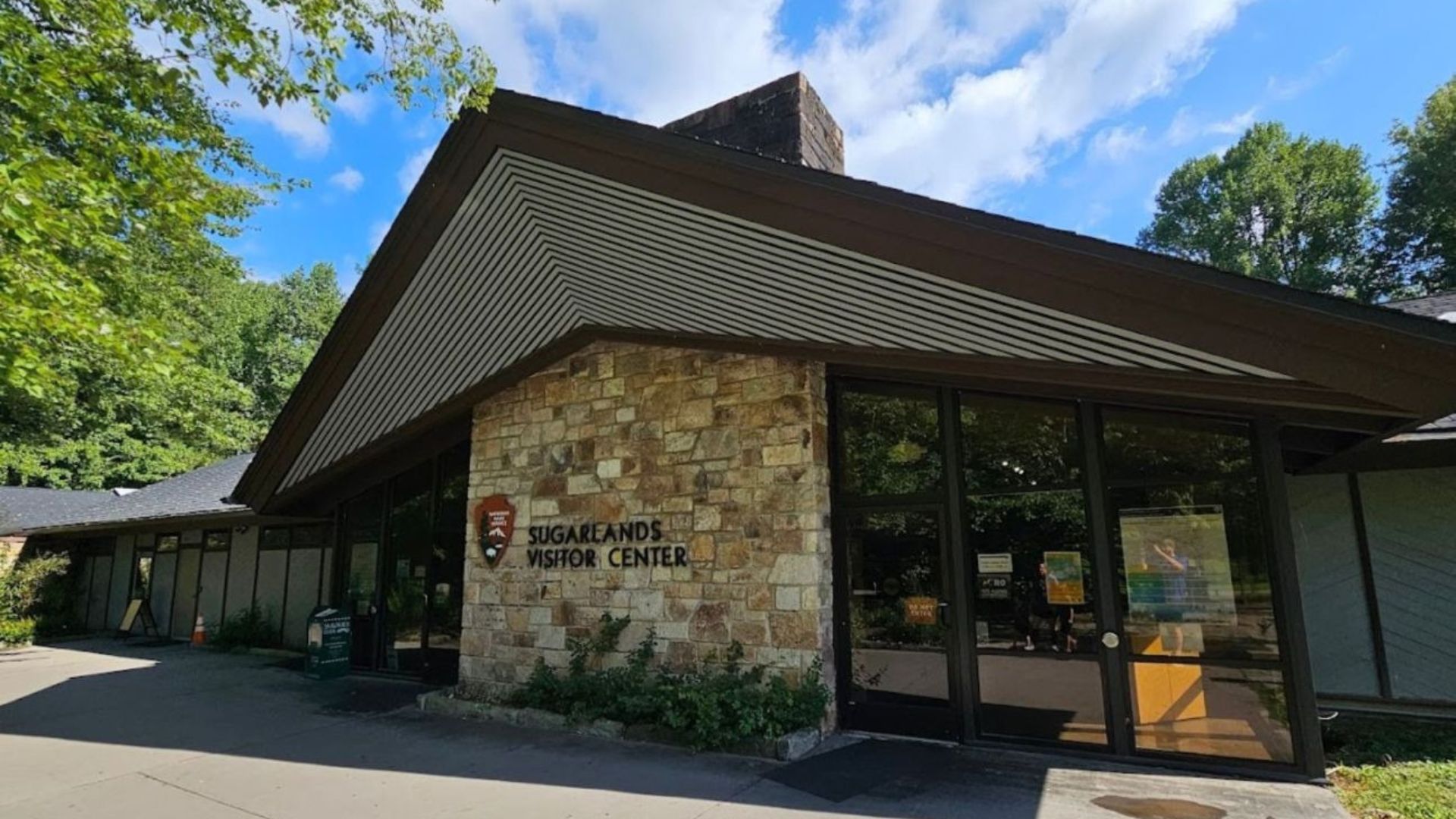
Two miles south of Gatlinburg on US-441, and the most useful first stop in the park — where you buy your parking tag, get a real map, and ask a ranger what's actually open today.
It takes twenty minutes and saves considerably more than that. Exhibits, restrooms, a bookstore, and three trailheads within walking distance of the door.
A paid tag is required for any vehicle parked over fifteen minutes anywhere in the park. You can buy one in person at Sugarlands, which is the simplest option if you didn't sort it out in advance at recreation.gov.
What it's actually good for
- Current conditions. Rangers know what's closed, what's icy, which trailhead lots are full, and whether Newfound Gap Road is open. That information isn't reliably online
- Real maps. Cell service disappears fast in the park, and a paper map is worth having
- Restrooms and water. The last dependable facilities before heading up Newfound Gap Road or out along Little River Road
- Trip planning. Tell the staff what you're up for — a two-hour walk, a full day, something with kids — and they'll match it to conditions
- The bookstore. Guidebooks, wildflower and bird identification, trail maps, and gifts that beat anything on the Parkway
The exhibits
A small museum covering the natural and cultural history of the Smokies — geology, biodiversity, the settlers who lived here before the park, and life-size wildlife dioramas that hold children's attention better than you'd expect.
Worth twenty minutes on the way in, and a good rainy-day option if the weather has ruined your plans. There's also a park film that runs through the day.
Trails from the door
Sugarlands Valley Nature Trail
A half-mile paved loop, wheelchair accessible, with interpretive signs. The easiest walk in the park and a genuinely pleasant one — river, forest, and the remains of old homesites.
Gatlinburg Trail
Runs from the visitor center along the river into downtown Gatlinburg, 3.8 miles round trip, flat gravel. It's one of only two trails in the entire park that permits dogs and bicycles. See our pet-friendly cabins.
Cataract Falls
Under a mile round trip from the visitor center to a small waterfall. The right length for young children. More short options on our kid-friendly hikes page.
Alum Cave and Laurel Falls
Both a short drive away. Alum Cave climbs toward the summit of Mount Le Conte, or you can turn around at the bluffs. Laurel Falls is the popular family waterfall walk on Little River Road.
Ranger programs
Guided hikes, wildlife talks, and evening programs run through the year, with the schedule posted at the center and at nps.gov. They're free, and a ranger-led walk is a considerably better introduction to the park than reading signs alone.
The synchronous firefly display at Elkmont each June is one of the most remarkable natural events in the country — and access is controlled by a lottery with very limited spots, held months in advance.
You can't turn up for it. If you want to be there, watch nps.gov for the lottery announcement, usually in spring.
Where it sits
Sugarlands is the junction of the park's two main routes. Newfound Gap Road climbs south from here to 5,046 feet and on to North Carolina; Little River Road runs west toward Townsend and Cades Cove.
The Roaring Fork Motor Nature Trail is a few minutes back toward Gatlinburg. Whatever you're doing in the park, you'll pass this building — see our full scenic drives guide.
Frequently asked questions
Where is it?
Two miles south of downtown Gatlinburg on US-441, at the junction with Little River Road.
Is there an entrance fee?
No — the park is free to enter and the visitor center is free. A paid parking tag is required for any vehicle parked over fifteen minutes, and you can buy one here.
What are the hours?
Open daily year-round except Christmas Day, with hours varying seasonally. Check nps.gov before an early or late visit.
Are there restrooms?
Yes — and they're the last reliable ones before you head up Newfound Gap Road.
What's the easiest trail from here?
The Sugarlands Valley Nature Trail, a half-mile paved and wheelchair-accessible loop starting at the center.
Can I bring my dog?
The Gatlinburg Trail from the visitor center is one of only two trails in the park that allows dogs. Most others don't.
How do I see the synchronous fireflies?
Through the annual lottery, which opens months ahead and has limited spots. Watch nps.gov in spring for the announcement.
Is it worth stopping if I've been to the park before?
For current conditions, yes. Road and trail status changes constantly, and five minutes with a ranger is more reliable than anything online.
Sugarlands is ten minutes from downtown Gatlinburg, which makes it an easy first stop from a cabin nearby. Browse Gatlinburg cabins and cabins near the national park, or cabins with mountain views. More in the park on our Smokies guide, trails guide, and picnic spots. Check the current specials, or use the vacation planner.