Newfound Gap
The highest point you can drive to on the main road through the park — 5,046 feet, twenty minutes from Gatlinburg, with ridgelines stacked to the horizon and a parking area that straddles the Tennessee–North Carolina line.
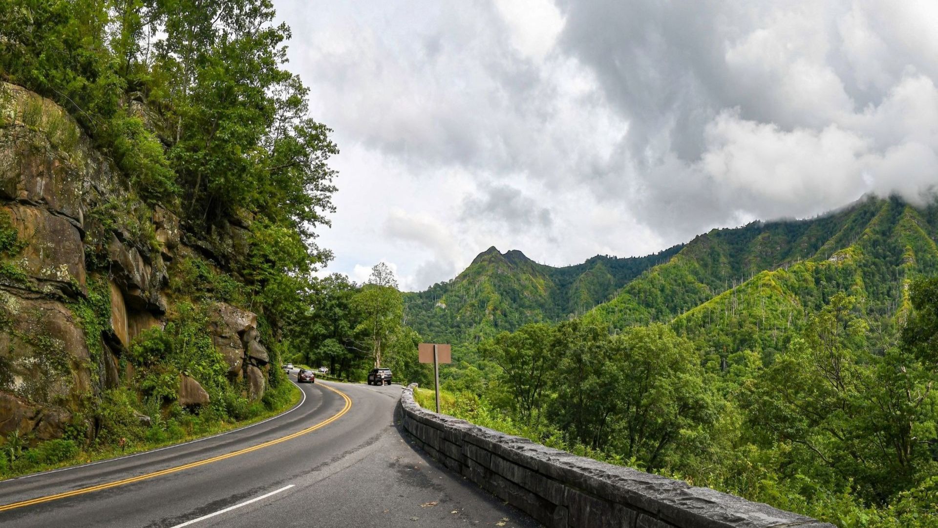
The highest point you can drive to on the main road through the park — 5,046 feet, with ridgelines stacked to the horizon and a parking area that straddles the Tennessee–North Carolina state line.
Newfound Gap is the most accessible high-elevation spot in the Smokies, twenty minutes up from Gatlinburg, and it's where the Appalachian Trail crosses the road. If you only make one drive into the park, make it this one.
It's a short drive from town — see Gatlinburg cabins, the closest of our markets.
Before you go
- A parking tag is required for any vehicle parked more than fifteen minutes, including here. Buy at recreation.gov before you set out
- Newfound Gap Road closes in winter weather. It's the first road in the park to shut for ice and snow, sometimes when Gatlinburg is merely wet. Check the park's road status before a winter drive
There are restrooms at the parking area, which is worth knowing — they're the last ones for a while in either direction.
The views
The overlook gives you layered ridges receding to the horizon, and it's the view most people picture when they think of the Smokies. It's particularly good in autumn, when the color runs down the slopes below you, and in winter with snow on the peaks and clear air.
For photographers this is one of the most reliable spots in the park — sunrise, the mist that gives the mountains their name, or the fall color, all from a paved parking area you don't have to hike to.
The state line runs right through the parking area, marked on the ground. Standing with one foot in Tennessee and one in North Carolina is the obligatory photo, and every family does it.
Hiking from the gap
The Appalachian Trail
The AT crosses the road here on its way from Georgia to Maine, which means you can walk a section of it without committing to anything. Head north or south from the parking area for as far as you feel like and turn around.
In spring you'll pass thru-hikers roughly a quarter of the way into a five-month walk, which is worth a conversation if they're stopped.
Charlies Bunion
The classic day hike from here — eight miles round trip north along the AT to a rocky outcrop with genuinely dramatic views. Moderate to strenuous, with real exposure at the destination. Allow five to six hours.
Kuwohi
Seven miles by road from Newfound Gap, then a steep paved half-mile to the observation tower at 6,643 feet — the highest point in the Smokies. Short, but the grade is no joke.
The mountain, formerly known as Clingmans Dome, was officially restored to its Cherokee name, Kuwohi, in 2024. The access road closes seasonally in winter, so check before driving out.
Where the park was dedicated
Newfound Gap is where President Franklin D. Roosevelt formally dedicated Great Smoky Mountains National Park in 1940. The stone monument at the overlook — the Rockefeller Memorial — marks the spot, with plaques explaining the park's creation and the campaign to protect the land.
It's a genuinely significant place in the history of American conservation, and most visitors walk past it to get to the view.
Ecology at 5,000 feet
The elevation puts Newfound Gap in a different world from the valleys. Cooler temperatures and heavier rainfall support Fraser fir and red spruce — trees normally found far to the north, surviving here as remnants of the last Ice Age.
Black bears, white-tailed deer, and a wide range of birds live in this zone. Birding is especially good in spring and summer.
See more on how elevation shapes the Smokies.
Making a day of it
Newfound Gap works well as the middle of a loop rather than a destination in itself:
- Drive up from Gatlinburg — about twenty minutes, climbing through every forest zone on the way
- Add Kuwohi — seven miles further, weather and season permitting
- Walk a piece of the AT — even a mile out and back is worth doing
- Continue into North Carolina — Oconaluftee and Cherokee are on the far side, and the elk at Cataloochee are reachable from there
- Or turn back and stop at the Gatlinburg Scenic Overlook on the Bypass for a different view of the valley
Frequently asked questions
How high is Newfound Gap?
5,046 feet — the highest point on Newfound Gap Road, and the most accessible high-elevation spot in the park.
How far is it from Gatlinburg?
About twenty minutes by car, straight up US-441 through the park.
Do I need a parking pass?
Yes, for any vehicle parked more than fifteen minutes. Buy in advance at recreation.gov.
Is the road open year-round?
Not reliably. Newfound Gap Road closes during winter storms and is often the first road in the park to shut. Check the park's road status before a December-to-March drive.
Can I get to Kuwohi from here?
Yes — seven miles by road, then a steep paved half-mile walk to the tower. The access road closes seasonally in winter.
What's the hike to Charlies Bunion like?
Eight miles round trip on the Appalachian Trail, moderate to strenuous, five to six hours. The views at the end are among the best in the park, with real exposure — keep children close.
Why is there a monument?
Franklin D. Roosevelt dedicated the national park here in 1940. The Rockefeller Memorial marks the spot.
How much colder is it than town?
Roughly fifteen degrees cooler than Gatlinburg, before wind. Bring a layer even on a warm day — people regularly arrive in shorts and regret it.
Newfound Gap is twenty minutes from downtown Gatlinburg, which makes it an easy morning from a cabin on that side. Browse Gatlinburg cabins and cabins near the national park, or cabins with mountain views if you want the scenery from your own deck. Coming for the color? Fall cabin rentals. Check the current specials, or use the vacation planner to plan the trip.