4 Best Swimming Spots in the Smoky Mountains
Published Mar 5, 2023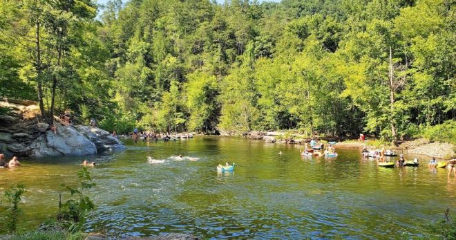
The rivers and creeks of Great Smoky Mountains National Park run cold, clear, and fast — fed by mountain streams that maintain cool temperatures even in midsummer. These four spots offer the best access to that water, from a wide tubing confluence to a deep swimming hole halfway up a trail.
Townsend Wye
Townsend Wye is where the Little River meets Laurel Creek — a Y-shaped confluence that creates one of the most accessible and family-friendly water spots in the national park. The pebble-lined banks are gentle enough for young children to wade along the edges, while the deeper channel toward the middle provides faster current for tubing. Inner tubes can be rented from outfitters in nearby Townsend, making this a natural stop on a Wears Valley or Cades Cove day. The wide, open character of the confluence gives groups plenty of room to spread out without crowding. Townsend Wye is located along Laurel Creek Road, approximately 18 miles west of the Sugarlands Visitor Center in Gatlinburg — or about 5 minutes from Townsend coming in from the western entrance. A Park It Forward parking tag is required.
Metcalf Bottoms
Metcalf Bottoms Picnic Area is the most developed water access point in the park — more than 100 picnic sites with tables and grills spread along both banks of the Little River, all first-come, first-served. The river at Metcalf Bottoms is wide and shallow, which makes it better for wading, splashing, and cooling off than for swimming; the current is gentle and the riverbed is rocky and accessible. Pack a picnic, claim a table, and let the kids wade while everyone else eats — it's the most relaxed water experience in the park, without the current concerns of the deeper spots. From the Sugarlands Visitor Center, take Little River Road west toward Elkmont, then turn right onto Wear Cove Gap Road to reach the picnic areas.
The Sinks
The Sinks is the most dramatic water feature on this list — a compact but powerful waterfall formed when dynamite cleared a logjam in the Little Pigeon River decades ago. The blast carved a 10-foot-deep pool at the base of the falls where the full force of the river pours in. The pool has been a favorite of locals and visitors for generations, and the emerald-green water is striking on a clear day. The Sinks has real hazards: the current and hydraulic forces at the base of the falls are dangerous, and swimming directly in the churning water below the falls is not advisable. The calmer pool downstream from the falls is where most people swim. Water shoes are strongly recommended on the rocky riverbed. Keep a close eye on children at all times — the combination of the depth, the current, and the slippery rocks demands attention. From Sugarlands, take Little River Road west approximately 12 miles.
Chimney Tops Trail Swimming Hole
The Chimney Tops Trail is one of the most popular hikes in the national park — a 4-mile round trip with significant elevation gain to the distinctive twin rock summits. But early on the trail, before the serious climbing begins, you'll cross a bridge over a mountain stream and spot a deep, crystal-clear swimming hole below. Take the stairs down to reach it. The pool is cold, clean, and sheltered by the forest — one of the better swimming holes accessible from a maintained trail in the park. If your group isn't up for the full hike to the summits, the swimming hole is a worthwhile destination in its own right; it's in the first portion of the trail and requires minimal effort to reach. The Chimney Tops trailhead is accessed from Newfound Gap Road, approximately 7 miles south of the Gatlinburg park entrance.
Frequently asked questions
Is swimming allowed in Great Smoky Mountains National Park?
Swimming and wading are permitted throughout the national park at your own risk — there are no designated swimming beaches, lifeguards, or enforced restrictions on water access in most areas. The park does not prohibit swimming in its streams and rivers. The main safety concerns are cold water temperatures (streams fed by mountain snowmelt stay cold even in summer), slippery rocks, and unpredictable current, particularly at falls and cascades. Never swim at the base of a waterfall where hydraulic forces are present.
What should I bring for a swimming day in the Smokies?
Water shoes are essential — the park's streambeds are rocky and slippery, and bare feet on wet stone are a reliable way to fall. A change of clothes and towels, sunscreen, and snacks or a picnic for Metcalf Bottoms or Townsend Wye. A Park It Forward parking tag ($5/day, $15/week, $40/annual) is required for any vehicle parked inside the national park for more than 15 minutes. Buy online at recreation.gov, at park visitor centers, or at kiosks near entrances before your visit.
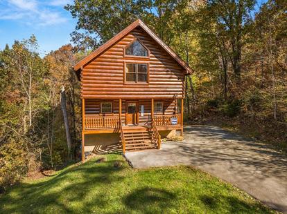
A Wears Valley cabin puts Townsend Wye and Metcalf Bottoms within 15 minutes — the best base for a swimming day on the western side of the park.