Andrews Bald
An open grassy meadow at 5,920 feet — the highest bald in the park, with long views toward Fontana Lake. Under four miles round trip, and in late June the flame azalea turns the whole thing orange.
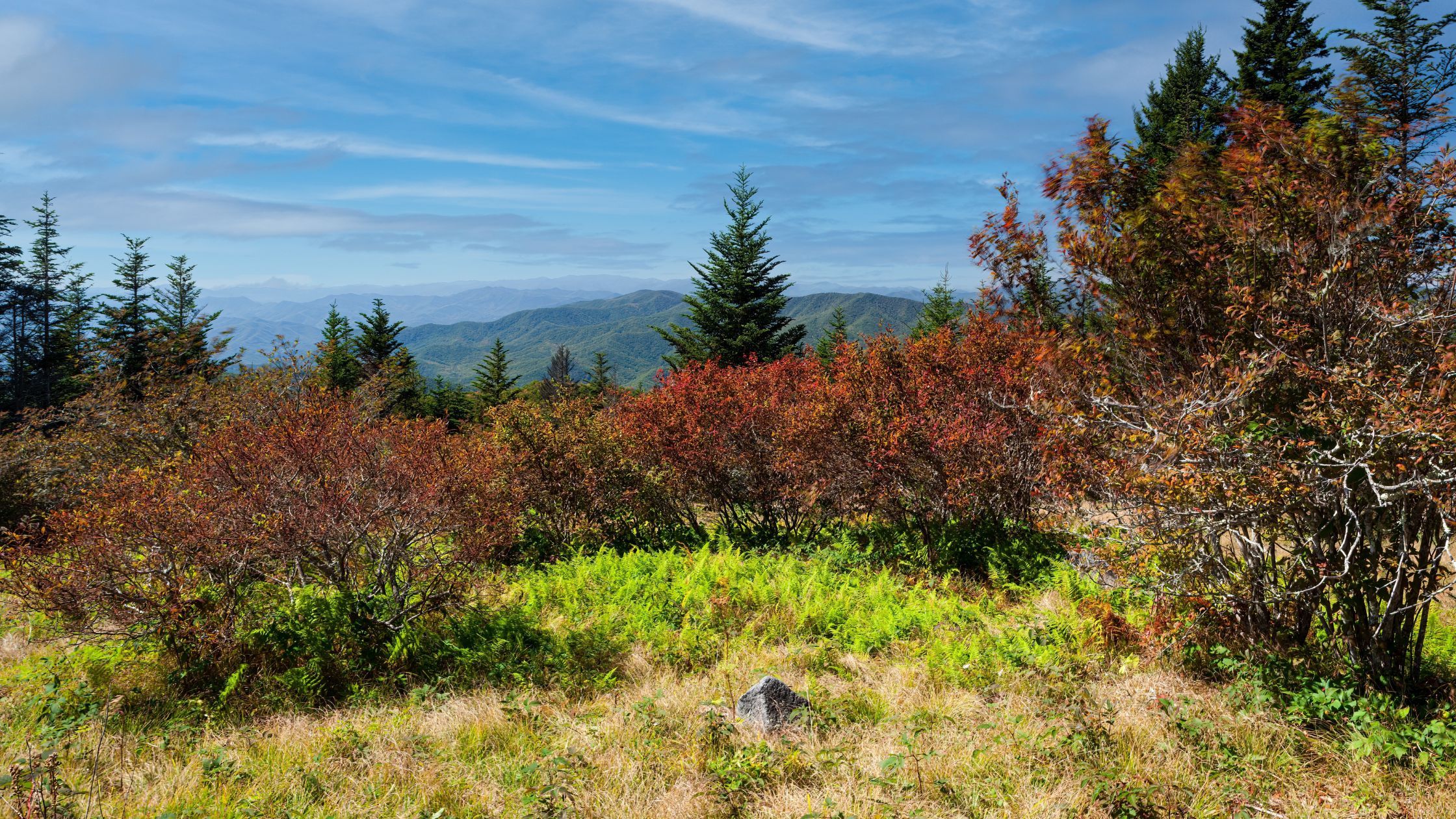
An open grassy meadow at 5,920 feet — the highest bald in the park, with long views south toward Fontana Lake and the North Carolina mountains.
It's the rare Smokies hike that trades forest for open sky, and at under four miles round trip it's one of the shortest routes to a big view anywhere in the park. In late June the flame azalea turns the whole meadow orange.
| Distance | 3.6 miles round trip |
|---|---|
| Trail | Forney Ridge Trail |
| Elevation at the bald | 5,920 feet |
| Time | 2 to 3 hours |
| Trailhead | Kuwohi parking area |
The Kuwohi parking area sits above the bald, so you descend roughly 600 feet on the way out and climb all of it on the return — at around 6,000 feet, where the air is thinner.
People routinely misjudge this, walking out easily and finding the return considerably harder. Save energy and water for the second half.
Before you go
- The Kuwohi access road closes for winter, typically from early December through the end of March. The trailhead is unreachable by car during that stretch
- A parking tag is required for any vehicle parked over fifteen minutes. Buy at recreation.gov beforehand
- The Kuwohi lot fills early in summer and autumn — it's the busiest trailhead in the park
- It's cold up here. The bald runs fifteen to twenty degrees below Gatlinburg, and the open meadow catches wind. Bring layers even in July
- The trail is rocky and uneven in sections despite the modest distance. Proper footwear helps
The trail
The Forney Ridge Trail starts from the Kuwohi parking area, which makes this an easy addition to a trip to the observation tower — two very different high-elevation experiences from one parking spot.
The route runs through dense spruce-fir forest, the cool, damp high-elevation woodland that exists only above about 4,500 feet here. It's shaded, quiet, and smells of evergreen. Rhododendron and mountain laurel line the trail through spring and summer.
At 1.8 miles the forest simply opens, and you're standing in a meadow.
The bald
Andrews Bald is a grassy, treeless expanse near the top of the ridge, and the openness is the whole point — most of the Smokies is dense forest, and standing in open ground at nearly 6,000 feet feels entirely different.
On a clear day the views run for miles: Fontana Lake to the south, the North Carolina side of the park, and ridge after ridge fading into the distance. It's a natural picnic spot, and most people who make the walk end up sitting for a while.
Nobody's entirely sure. The Southern Appalachian balds are grassy openings well below the natural treeline, and theories range from grazing by early settlers and their livestock, to fire, to Ice Age remnants. The Park Service actively manages Andrews Bald to keep it open — without intervention the forest would reclaim it.
Wildflowers
Late June is the reason to plan a trip around this hike. Flame azalea — brilliant orange, and unlike anything else in the park — blooms across the bald, with rhododendron following. It's one of the best wildflower displays in the Smokies and it draws photographers accordingly.
Spring brings other blooms along the trail, and autumn gives you the color on the surrounding ridges seen from open ground rather than through trees.
Wildlife
The open meadow and high elevation support a different mix from the valleys — birds, small mammals, and occasionally black bears, though sightings here are less common than in Cades Cove.
When to go
- Late June — the flame azalea peak, and the single best time to be here
- Summer — pleasant hiking with a genuine temperature break from the valleys. Start early; the lot fills
- Autumn — color across the ridges, viewed from open meadow
- Winter — not practical. The access road closes and the trailhead can't be reached by car
Combining it with Kuwohi
The same parking area serves both. The half-mile paved climb to the Kuwohi observation tower gives you the highest point in the Smokies and a 360-degree view; Andrews Bald gives you open meadow and a longer walk.
Doing both makes a solid half-day, and the tower is short enough that most people manage it even after the bald. Read more on elevation in the Smokies.
Frequently asked questions
How long is the hike?
3.6 miles round trip on the Forney Ridge Trail, taking most people two to three hours including time at the bald.
How hard is it?
Moderate. The distance is short but the trail is rocky, the elevation is high, and the return is uphill the whole way. Manageable for most reasonably fit hikers and older children.
Where does it start?
The Kuwohi parking area, seven miles off Newfound Gap Road. Kuwohi was formerly named Clingmans Dome.
Can I hike it in winter?
Not easily — the Kuwohi access road closes from early December through late March, which puts the trailhead out of reach by car.
When do the flame azaleas bloom?
Typically late June, though it shifts with the weather. It's the highlight of the year here and worth timing a trip around.
Do I need a parking pass?
Yes, for any vehicle parked over fifteen minutes. Buy in advance at recreation.gov.
Is it good for kids?
For children who can manage 3.6 miles with a sustained climb at the end, yes — and the open meadow is a genuinely fun destination. For younger kids, see our kid-friendly hikes instead.
What's a bald?
A grassy, treeless area high on a Southern Appalachian ridge, well below where trees would naturally stop growing. Their origin isn't settled — grazing, fire, and Ice Age history have all been proposed. The Park Service mows and manages Andrews Bald to keep it from filling in.
Kuwohi is about an hour from Gatlinburg, which makes this a comfortable morning from a cabin on that side. Browse Gatlinburg cabins and cabins near the national park, or cabins with mountain views for the same scenery from your deck. More hiking: Charlies Bunion, Mount Le Conte, and easy family trails. Check the current specials, or use the vacation planner.