Mount Cammerer Trail
A 1937 stone lookout · 11.2-mile round trip
A long day out from Cosby to a squat stone-and-timber lookout the Civilian Conservation Corps built in 1937, from rock and timber gathered on the mountain itself. A ranger watched for fires from it into the 1960s, and after decades derelict it was restored in 1996.
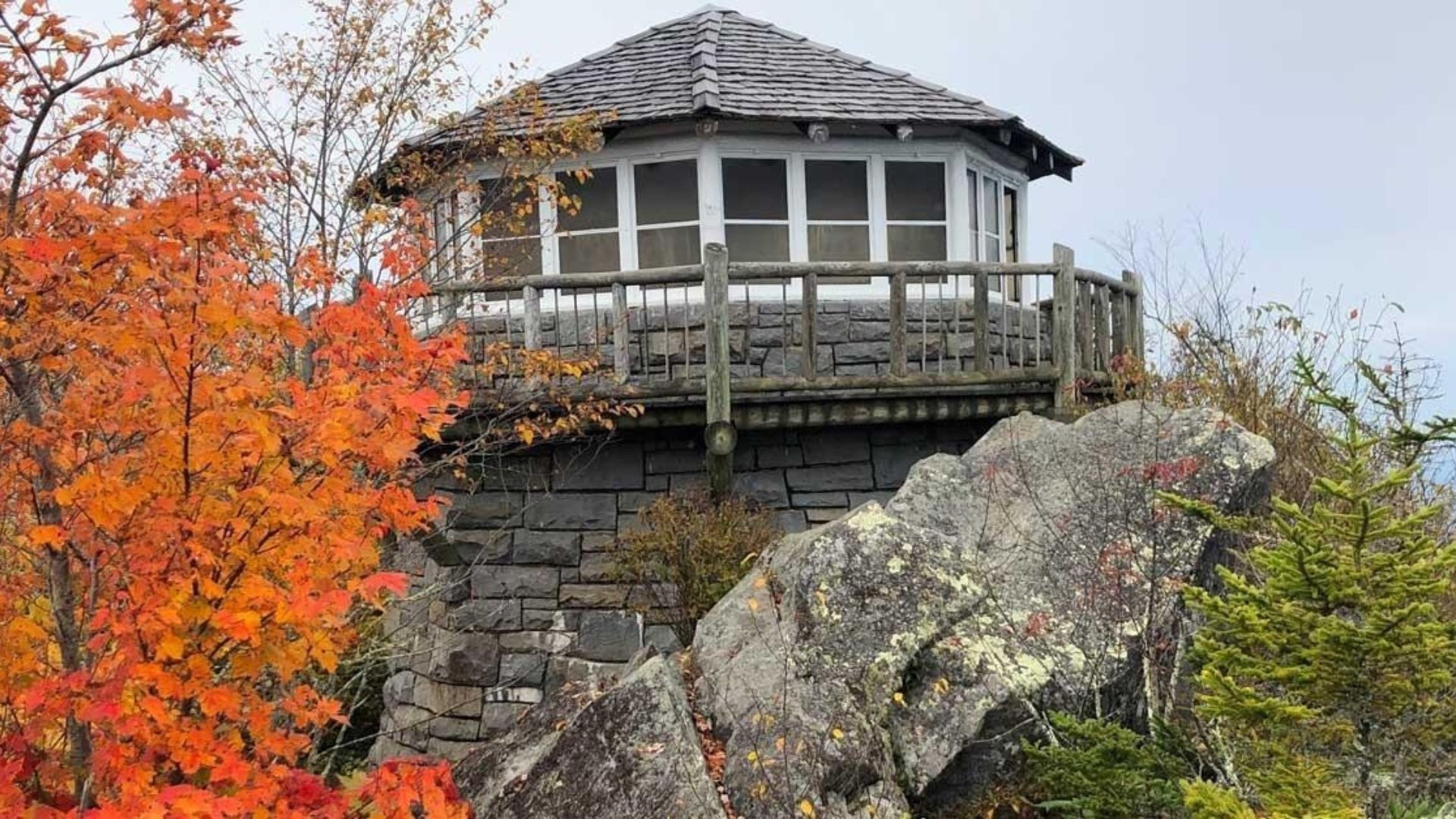
Mount Cammerer may have the best reward of any hike in the Great Smoky Mountains: a stone fire tower from the 1930s sitting on a rocky summit, with views stretching across the Smokies and far into Tennessee and North Carolina.
The most popular way to the top is the Mount Cammerer Trail route from Cosby. It climbs the Low Gap Trail, follows the Appalachian Trail along the ridge, and finishes on a short spur to the tower. It's a long, tough day hike, but for strong hikers it's one of the most memorable in the park.
Mount Cammerer hike at a glance
Distance: about 11 miles round trip
Climb: about 3,000 feet
Summit elevation: 4,928 feet
Difficulty: strenuous, full-day hike
Trailhead: Low Gap Trail near Cosby Campground
Pets: not allowed on this trail
Finding the Mount Cammerer trailhead
The hike begins at the Low Gap trailhead near Cosby Campground, on the quiet northeast side of the national park. From Gatlinburg, take US 321 east toward Cosby, then follow the signs into the Cosby section of the park. Park in the hiker parking area near the campground.
Bring a parking tag — a national park parking tag is required for any vehicle parked longer than fifteen minutes. See our guide to where to buy a Smokies parking pass.
Check access before you go — roads and facilities in the Cosby area can change with the seasons, so check the national park's website for current conditions.
What the hike is like
Low Gap Trail
The first stretch is the hardest. The Low Gap Trail climbs steadily through hardwood forest for nearly three miles to Low Gap on the Appalachian Trail. It's a steep, steady climb, so take your time and rest as you need to.
The Appalachian Trail
At Low Gap, turn left onto the Appalachian Trail. The climbing eases as the trail follows the ridge, and you'll start to catch glimpses of the mountains through the trees.
The Mount Cammerer spur
A signed side trail leaves the Appalachian Trail for the last 0.6 miles to the summit. This stretch is fairly level, with a little rock scrambling just before the tower.
The Mount Cammerer fire tower
The Civilian Conservation Corps built the lookout tower in 1937 from local stone and timber, and fire watchers kept an eye on the forest from here for decades. After years of decline, the tower was restored in 1996. Today you can climb up and step inside for a 360-degree view.
From the top, the Smokies roll out in every direction, with the Pigeon River valley far below and ridge after ridge fading into the distance. The mountain is named for Arno B. Cammerer, a National Park Service director who helped establish the park. It was once called White Rock for the pale quartzite at the summit.
Tips for hiking Mount Cammerer
Start early — this is a full-day hike, and you'll want plenty of daylight for the trip back down.
Pack plenty of water and food — there's no water at the summit, and the climb is long.
Dress in layers — the summit is often windy and much cooler than the trailhead.
Watch your footing at the top — the rocks around the tower can be slippery, and there are steep drop-offs. Keep a close eye on children.
Watch the weather — the open summit is no place to be in a thunderstorm. Turn back if storms roll in.
Best time to hike Mount Cammerer
Spring — wildflowers bloom along the lower trail, and the views are crisp on clear days.
Summer — long days for a long hike, but start early to beat the heat and afternoon storms.
Fall — the view from the tower is spectacular when the leaves change. Plan a leaf-season trip with our fall cabin rentals.
Winter can bring ice and snow on the ridge. Check trail and road conditions with the national park before any visit.
More big-view hikes in the Smokies
Love a summit with a view? Try the Alum Cave Trail toward Mount LeConte, the steep climb to the Chimney Tops observation point, or the June azaleas on Gregory Bald. Browse all our Smoky Mountain hiking trails for more ideas.
Frequently asked questions
How long is the Mount Cammerer hike?
About eleven miles round trip from Cosby via the Low Gap Trail and the Appalachian Trail.
How hard is the Mount Cammerer hike?
It's strenuous. The trail climbs about 3,000 feet, with the steepest part on the Low Gap Trail.
Can you go inside the Mount Cammerer fire tower?
Yes. The restored stone lookout is open to hikers and offers 360-degree views.
How high is Mount Cammerer?
The summit sits at 4,928 feet on the Tennessee and North Carolina state line.
Where does the Mount Cammerer hike start?
At the Low Gap trailhead near Cosby Campground, on the northeast side of the national park.
Can I bring my dog?
No. Dogs aren't allowed on Mount Cammerer trails or most other trails in the national park.
Make the climb to Mount Cammerer the highlight of your Smoky Mountain vacation. Our Gatlinburg cabins put you on the road to Cosby for an early start, and our mountain view cabins let you keep enjoying the scenery long after the hike. After a long day on the trail, rest tired legs in one of our hot tub cabins, and if the dog is coming along, our pet-friendly cabins have room for them too.