Alum Cave Trail
An 80-foot bluff, not a cave · 4.4-mile round trip
A huge concave overhang reached from Newfound Gap Road, by way of Arch Rock and the stone staircase cut through it. Keep going another three miles and you top out on Mount LeConte. The bluffs ice over in winter, so check conditions before you set out.
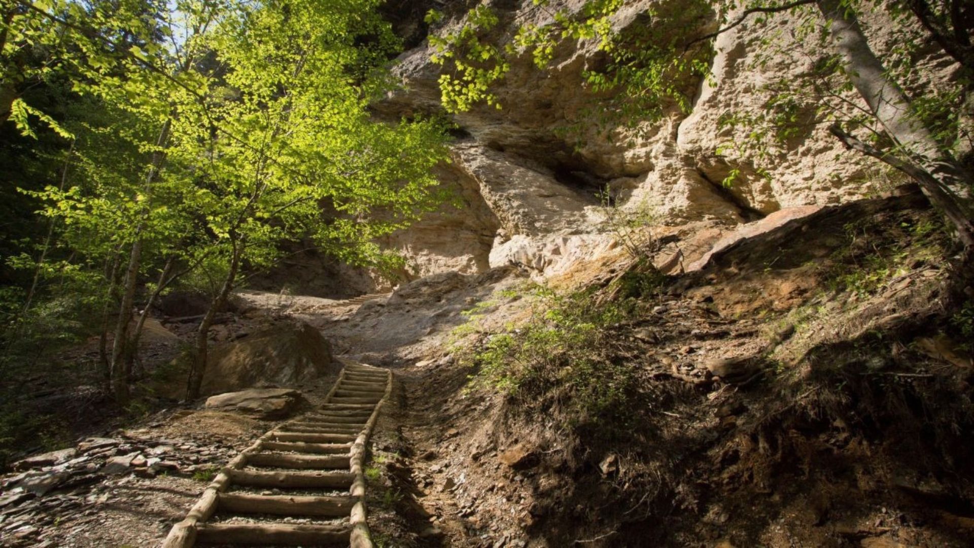
The Alum Cave Trail is one of the most popular hikes in Great Smoky Mountains National Park, and it's easy to see why. In just a few miles it packs in a rushing mountain stream, a natural stone arch, a big valley view, and the towering Alum Cave Bluffs.
Most hikers turn around at the bluffs for a rewarding half-day hike. Stronger hikers can keep going all the way to the top of Mount LeConte. However far you go, this is a trail you'll remember.
Alum Cave Trail at a glance
To Mount LeConte: about 10 to 11 miles round trip
Difficulty: moderate to the bluffs, challenging to the summit
Trailhead: Newfound Gap Road (US 441), about 8.6 miles from Sugarlands Visitor Center
Pets: not allowed on this trail
Finding the Alum Cave trailhead
The Alum Cave trailhead is on Newfound Gap Road (US 441), about eight and a half miles past Sugarlands Visitor Center when you're driving from Gatlinburg. There are two parking areas at the trailhead, along with pit toilets.
Arrive early — this is one of the busiest trailheads in the park, and parking fills up fast, especially on weekends and in October. Get there early in the morning, or look for a shuttle option, so you aren't circling for a spot.
Bring a parking tag — a national park parking tag is required for any vehicle parked longer than fifteen minutes. Our guide to where to buy a Smokies parking pass lists the easiest places to get one.
Highlights along the trail
Walker Camp Prong and Alum Cave Creek
The first stretch of trail is gentle. It follows a rushing stream through shady forest thick with rhododendron, crossing the water on footlog bridges. It's a beautiful warm-up and a great section for families who want a shorter outing.
Arch Rock
A natural stone arch where the trail climbs a set of rock stairs right through the opening, with a cable handrail to hold onto. It's one of the most photographed spots on the hike.
Inspiration Point
About two miles in, the trees open up onto a rocky outcrop with wide views across the valley. It's a good place to rest and take pictures before the final stretch to the bluffs.
Alum Cave Bluffs
At about 2.3 miles you'll reach Alum Cave Bluffs. Despite the name, it isn't a true cave. It's a huge overhanging cliff about eighty feet tall, and the ground underneath stays dry even when the air around it is damp. This is the turnaround point for most hikers, and a perfect place for a snack before heading back down.
Continuing to Mount LeConte
From the bluffs, the trail keeps climbing about three more miles to the top of Mount LeConte, one of the tallest peaks in the Smokies. The Alum Cave Trail is the shortest route to the summit, but it's steep and rocky, with narrow ledges where cables are bolted to the rock for support. Our full guide to hiking Alum Cave Trail to Mount LeConte covers the summit hike in detail.
Is Alum Cave Trail dangerous?
The hike to the bluffs is moderate, but it still calls for care. Parts of the trail are steep, rocky, and slippery when wet, and the stairs at Arch Rock can be slick. Wear sturdy hiking shoes, carry plenty of water, watch your footing, and keep a close eye on children.
Best time to hike Alum Cave Trail
Spring — wildflowers and blooming rhododendron line the trail, and the streams run full.
Summer — the shady forest keeps the lower trail comfortable, but it's busy, so start early.
Fall — some of the best leaf color in the park, with big views from Inspiration Point. Plan a leaf-season trip with our fall cabin rentals.
Weekdays and early mornings are the quietest times any time of year. Check the national park's website before you go for any temporary trail or road closures.
More hikes in the Smokies
Looking for your next trail? Laurel Falls is a paved, family-friendly waterfall walk near Sugarlands. Grotto Falls lets you walk behind a waterfall, and Abrams Falls in Cades Cove is one of the park's most powerful waterfalls. Further up Newfound Gap Road, Newfound Gap is a great scenic stop. Browse all of our Smoky Mountain hiking trails for more ideas.
Frequently asked questions
How long is the Alum Cave Trail?
It's 2.3 miles to Alum Cave Bluffs, or about 4.6 miles round trip. The full trail to Mount LeConte is about ten to eleven miles round trip.
Where is the Alum Cave trailhead?
On Newfound Gap Road (US 441), about 8.6 miles from Sugarlands Visitor Center near Gatlinburg.
Is Alum Cave Trail hard?
The hike to the bluffs is moderate, with steady climbing and rocky stretches. Going on to Mount LeConte is a challenging, all-day hike.
Is Alum Cave a real cave?
No. Alum Cave Bluffs is a large overhanging cliff about eighty feet tall, not a true cave.
Do I need a parking pass?
Yes. A national park parking tag is required for any vehicle parked longer than fifteen minutes.
Can I bring my dog?
No. Pets aren't allowed on Alum Cave Trail. In the national park, dogs are allowed only on the Gatlinburg Trail and the Oconaluftee River Trail.
Alum Cave Trail is an easy drive from our Gatlinburg cabins, so you can be at the trailhead early and back in time for dinner. Our cabins near the national park keep the Smokies close, and our mountain view cabins let you enjoy the scenery long after the hike. Rest tired legs in one of our hot tub cabins, and if the dog is coming, our pet-friendly cabins have room for them too.