Chimney Tops
4,724 feet · 4-mile round trip, strenuous
A steep two-mile climb to one of the park's most recognizable summits, gaining around 1,400 feet on the way up. The upper section has been closed since the 2016 wildfire, so the chimneys themselves are off-limits — an overlook near the top gives you the view instead.
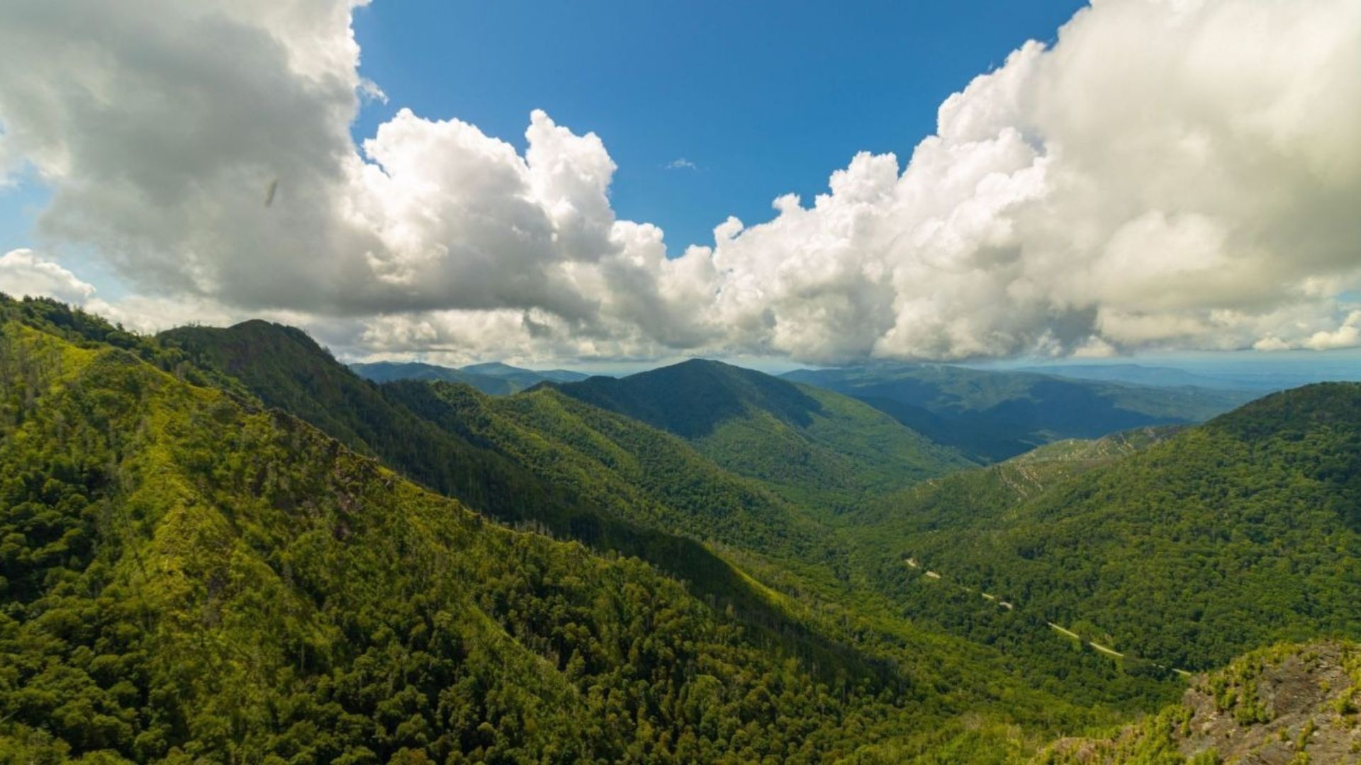
The Chimney Tops Trail is one of the most famous hikes in the Great Smoky Mountains. It's short but steep, and it climbs to a viewpoint facing the twin rocky peaks that gave Chimney Tops its name.
The trail packs a lot into a few miles: rushing streams, footbridges, old-growth forest, and a hard climb that ends with big views. Today it ends at an observation point just below the pinnacles, which still offers one of the best close-up views in the park.
Chimney Tops Trail at a glance
Climb: more than 1,000 feet, most of it in the last mile and a half
Difficulty: strenuous
Trailhead: Newfound Gap Road (US 441), about 7 miles from Sugarlands Visitor Center
Summit: the rock pinnacles are closed; the trail ends at an observation point
Pets: not allowed on this trail
Finding the Chimney Tops trailhead
The Chimney Tops trailhead is on Newfound Gap Road (US 441), about seven miles past Sugarlands Visitor Center when you're driving from Gatlinburg. Parking at the trailhead is limited and fills quickly, especially on weekends and during fall color season, so plan to arrive early.
Bring a parking tag — a national park parking tag is required for any vehicle parked longer than fifteen minutes. Our guide to where to buy a Smokies parking pass lists the easiest places to get one.
What the hike is like
The first mile
The trail starts gently, crossing a series of footbridges over the West Prong of the Little Pigeon River and Road Prong. These are some of the prettiest stream crossings in the park. Just under a mile in, the Road Prong Trail branches off to the right. Stay left to continue toward Chimney Tops.
The climb
After the bridges, the trail turns uphill and doesn't let up. Expect steady climbing on stone and log steps, with more than a thousand feet of elevation gained in about a mile and a half. Take breaks as you need them. This is the part of the hike most people remember.
The observation point
The trail ends at an observation point built after the 2016 wildfire. From here you'll look straight at the rocky Chimney Tops pinnacles, with Mount LeConte and the surrounding peaks spread out behind them. It's a great place to rest, take photos, and enjoy the view before heading back down the way you came.
Is the Chimney Tops summit closed?
Yes. The final stretch onto the rock pinnacles has been closed since the November 2016 wildfire badly damaged the top of the mountain. The rest of the trail reopened in 2017, and the new observation point now marks the end of the hike. A gate blocks the closed section, so please stay on the open trail. For the full story, read our update on what to expect since the Chimney Tops summit closure.
Tips for your hike
Start early — you'll get a better shot at parking, cooler temperatures on the climb, and a quieter trail.
Wear real hiking shoes — the trail is steep, rocky, and full of roots and steps that get slick when wet.
Carry plenty of water — the climb is short but hard, and there's no water to fill up along the way.
Watch the weather — snow and ice can make the trail dangerous in winter. Check conditions with the national park before you go.
Best time to hike Chimney Tops
Spring — wildflowers bloom along the streams, and the water runs full at the bridges.
Summer — the shady lower trail stays comfortable, but start early to beat the heat and crowds.
Fall — the view from the observation point is at its best when the leaves change. Plan a leaf-season trip with our fall cabin rentals.
More to see on Newfound Gap Road
Chimney Tops is one of several great stops along Newfound Gap Road. Just a few miles away, the Alum Cave Trail leads to Arch Rock and Alum Cave Bluffs, and the road climbs to Newfound Gap for sweeping views. The nearby Chimneys Picnic Area is one of our favorite picnic areas in the Smokies. Looking for something easier? Laurel Falls is a paved, family-friendly waterfall walk, and you'll find more ideas in our full list of Smoky Mountain hiking trails.
Frequently asked questions
How long is the Chimney Tops Trail?
About 3.5 to 4 miles round trip to the observation point.
How hard is Chimney Tops?
It's strenuous. The trail climbs more than a thousand feet in about a mile and a half, with lots of steps.
Can you still climb to the top of Chimney Tops?
No. The rock pinnacles have been closed since the 2016 wildfire. The trail ends at an observation point with views of the pinnacles.
Where is the Chimney Tops trailhead?
On Newfound Gap Road (US 441), about seven miles from Sugarlands Visitor Center near Gatlinburg.
Do I need a parking pass?
Yes. A national park parking tag is required for any vehicle parked longer than fifteen minutes.
Can I bring my dog?
No. Dogs aren't allowed on the Chimney Tops Trail.
Chimney Tops is a quick drive from our Gatlinburg cabins, so you can be at the trailhead early and back for a relaxing afternoon. Our cabins near the national park keep the trails close, and our mountain view cabins let you enjoy the scenery from your own deck. After the climb, unwind in one of our hot tub cabins, and if the dog is coming, our pet-friendly cabins have room for them too.