Middle Prong Trail
Tremont · 4.1 miles on an old railroad grade
An old logging railroad bed along the Middle Prong of the Little River — wide, flat and climbing gently, with cascades beside the path almost from the start. You don't have to go far for the payoff, though the trail runs 4.1 miles if you want a full day of it. The last stretch of Upper Tremont Road is gravel.
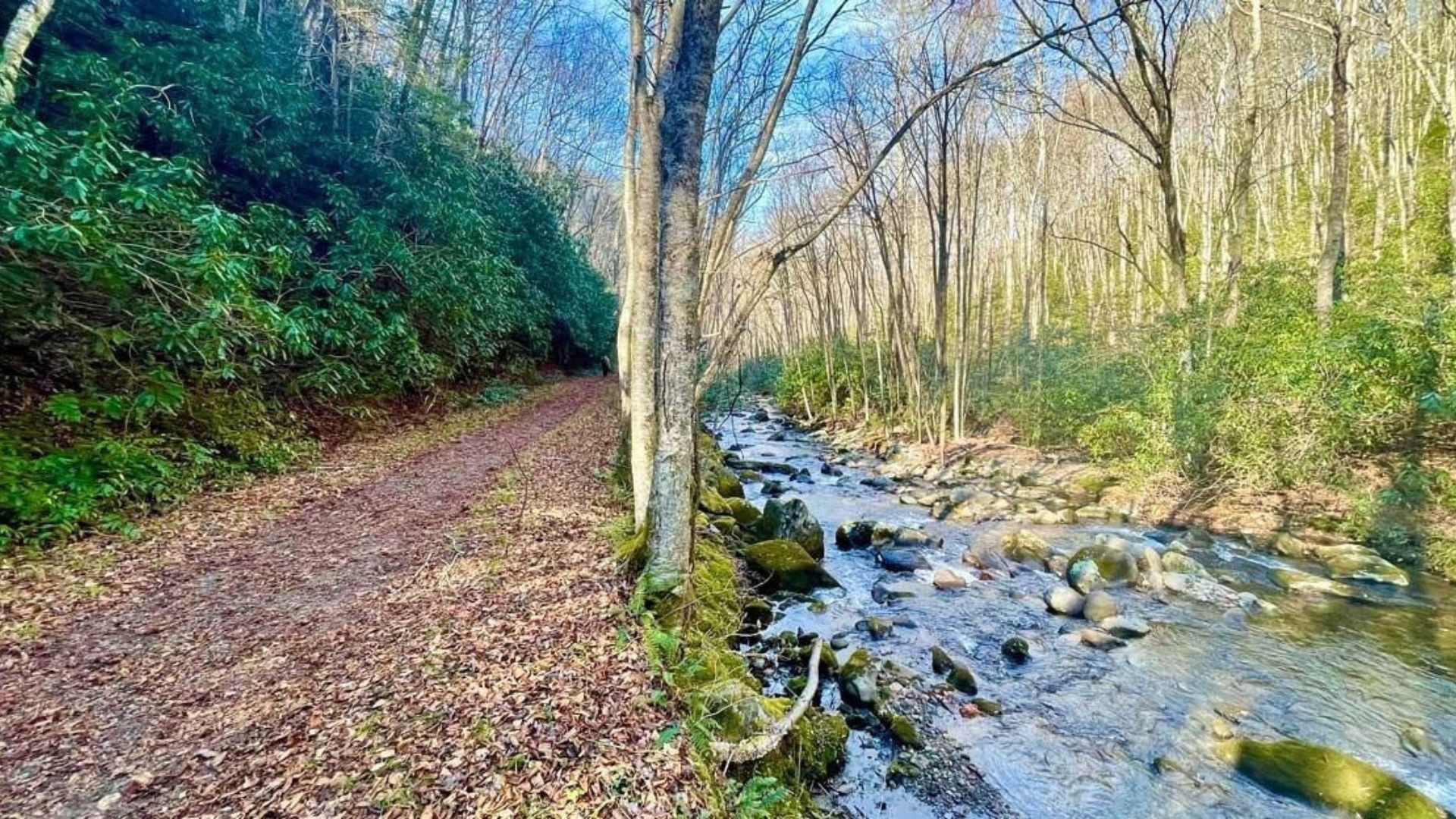
The Middle Prong Trail is one of the most rewarding riverside hikes in the Great Smoky Mountains. Starting in the quiet Tremont area near Townsend, it follows an old logging railroad bed along a rushing mountain stream, past roaring cascades, a rusting car from the 1930s, and a hidden three-tier waterfall.
Because the trail follows the old rail line, the grade stays gentle for most of the way. That makes it a great pick for families who want big scenery without a hard climb. Hike as far as you like and turn around whenever you're ready.
Middle Prong Trail at a glance
Lynn Camp Prong Cascades: about half a mile in
Old car: about 2 miles in
Indian Flats Falls: about 7 to 8 miles round trip
Climb: about 1,250 feet over the full trail
Difficulty: easy to moderate, on a gentle railroad grade
Trailhead: end of Tremont Road, near Townsend
Pets: not allowed on this trail
Finding the Middle Prong trailhead
From the Townsend Y, turn onto Tremont Road and follow it past the Great Smoky Mountains Institute at Tremont. The road turns to gravel and continues about five miles to a gate and a parking circle at the end of the road. The trail starts by crossing a high bridge over the Middle Prong of the Little River.
Bring a parking tag — a national park parking tag is required for any vehicle parked longer than fifteen minutes. See our guide to where to buy a Smokies parking pass.
Take it slow on Tremont Road — the gravel road is narrow in spots. Check the national park's road status before you go.
Highlights along the trail
A logging town's past
The trailhead sits where the logging town of Tremont once stood, a busy company town built by the Little River Lumber Company. The trail follows the old railroad bed that once hauled timber out of these woods. Look for leftover pieces of iron and stonework along the way. Remains of an old railroad trestle sit a short walk past the first cascades.
Lynn Camp Prong Cascades
About half a mile in, the stream pours down a long series of cascades, sometimes called Panther Falls by old-timers. It's one of the prettiest spots on the trail and an easy turnaround point for families with young kids.
The old car
About two miles in, a short side path on the right leads to the rusting frame of an old car that has sat in the woods since the 1930s. Most guidebooks call it a Cadillac, though some say it's actually a Packard. Either way, it's a fun surprise in the middle of the forest.
Indian Flats Falls
Past the Panther Creek Trail junction, the trail climbs a few switchbacks to the bridge over Indian Flats Prong. A short, rocky side path leads to Indian Flats Falls, a beautiful waterfall that drops in three tiers. It's a longer outing, about seven to eight miles round trip, but well worth it.
Tips for your hike
Pick your turnaround — the cascades make a short, easy walk, the old car is a good half-day goal, and Indian Flats Falls is a full morning or afternoon.
Watch for the side paths — the trails to the old car and Indian Flats Falls are easy to miss. Keep an eye out on the right side of the trail.
Stay off the rocks — the rocks around the cascades and falls are slippery, and the water is fast and cold.
Carry water and snacks — there are no services past Tremont.
Best time to hike Middle Prong Trail
Spring — wildflowers bloom along the trail and the cascades run at their fullest.
Summer — the shady riverside keeps the hike comfortable, and the trail is quieter than most in the park.
Fall — the hardwoods along the river turn bright colors. Plan a leaf-season trip with our fall cabin rentals.
Winter can bring ice, so check conditions with the national park before you head out.
More to explore nearby
Tremont is just a short drive from some of the park's best stops. Cades Cove and the hike to Abrams Falls are close by. Along Little River Road, you'll find The Sinks, the Metcalf Bottoms Trail, and the historic Walker Sisters Cabin. Browse all our Smoky Mountain hiking trails for more ideas.
Frequently asked questions
How long is the Middle Prong Trail?
About 4.1 miles one way. Most hikers turn around at the cascades, the old car, or Indian Flats Falls.
Where is the Middle Prong trailhead?
At the end of Tremont Road, about five miles past the Great Smoky Mountains Institute at Tremont, near Townsend.
Is Middle Prong Trail hard?
No. It follows an old railroad bed with a gentle grade. The longer hike to Indian Flats Falls is moderate because of the distance.
Where is the old car on Middle Prong Trail?
About two miles in, down a short side path on the right side of the trail.
How far is Indian Flats Falls?
About seven to eight miles round trip from the Middle Prong trailhead.
Can I bring my dog?
No. Dogs aren't allowed on the Middle Prong Trail.
Tremont is an easy drive from our Wears Valley cabins and a short trip from Pigeon Forge and Gatlinburg. Our Wears Valley cabins and cabins near Cades Cove put you close to this quiet side of the park, and our riverfront cabins keep the sound of running water close by. After a day on the trail, relax in one of our hot tub cabins, and if the dog is coming along, our pet-friendly cabins welcome them too.